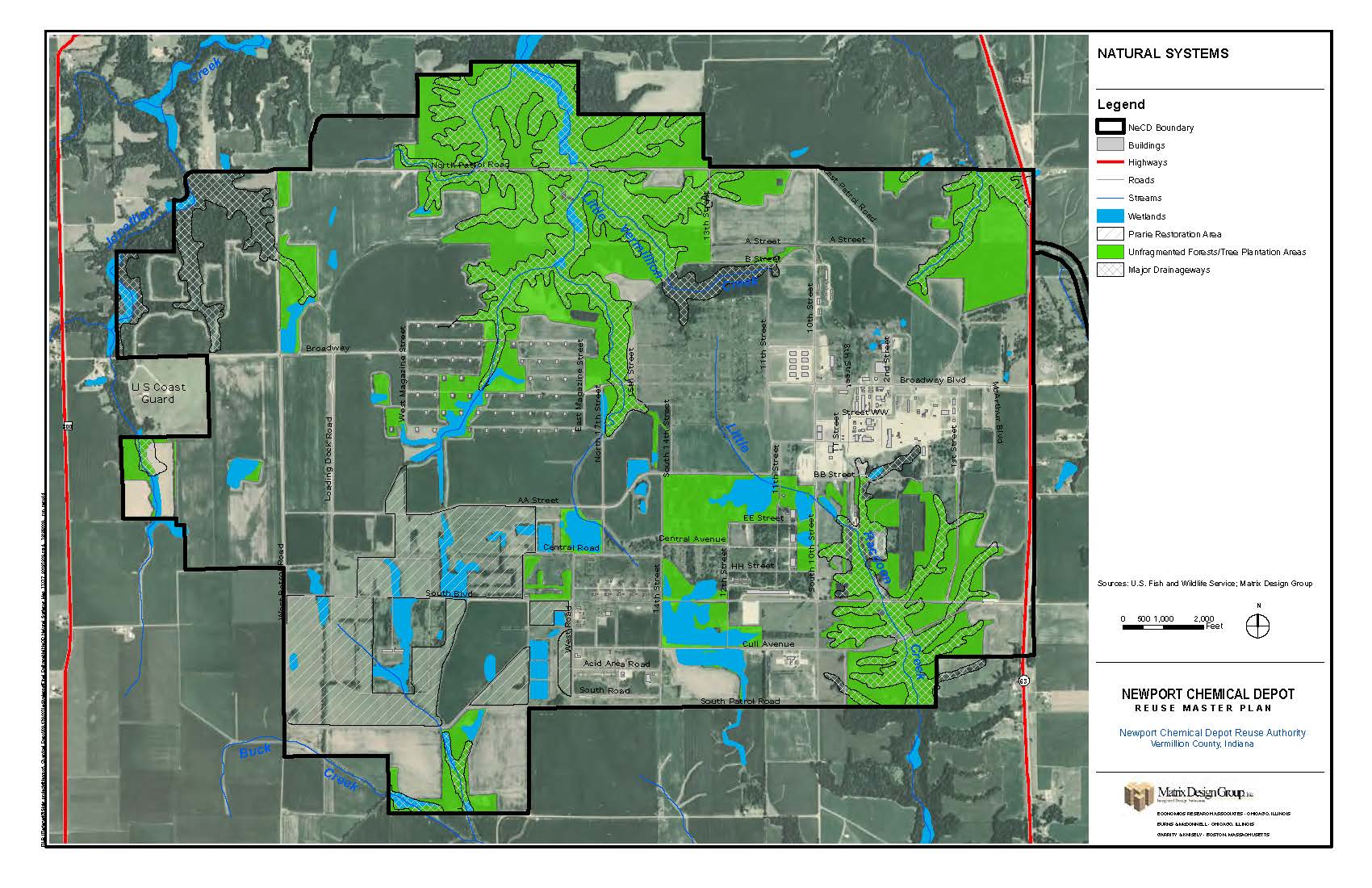
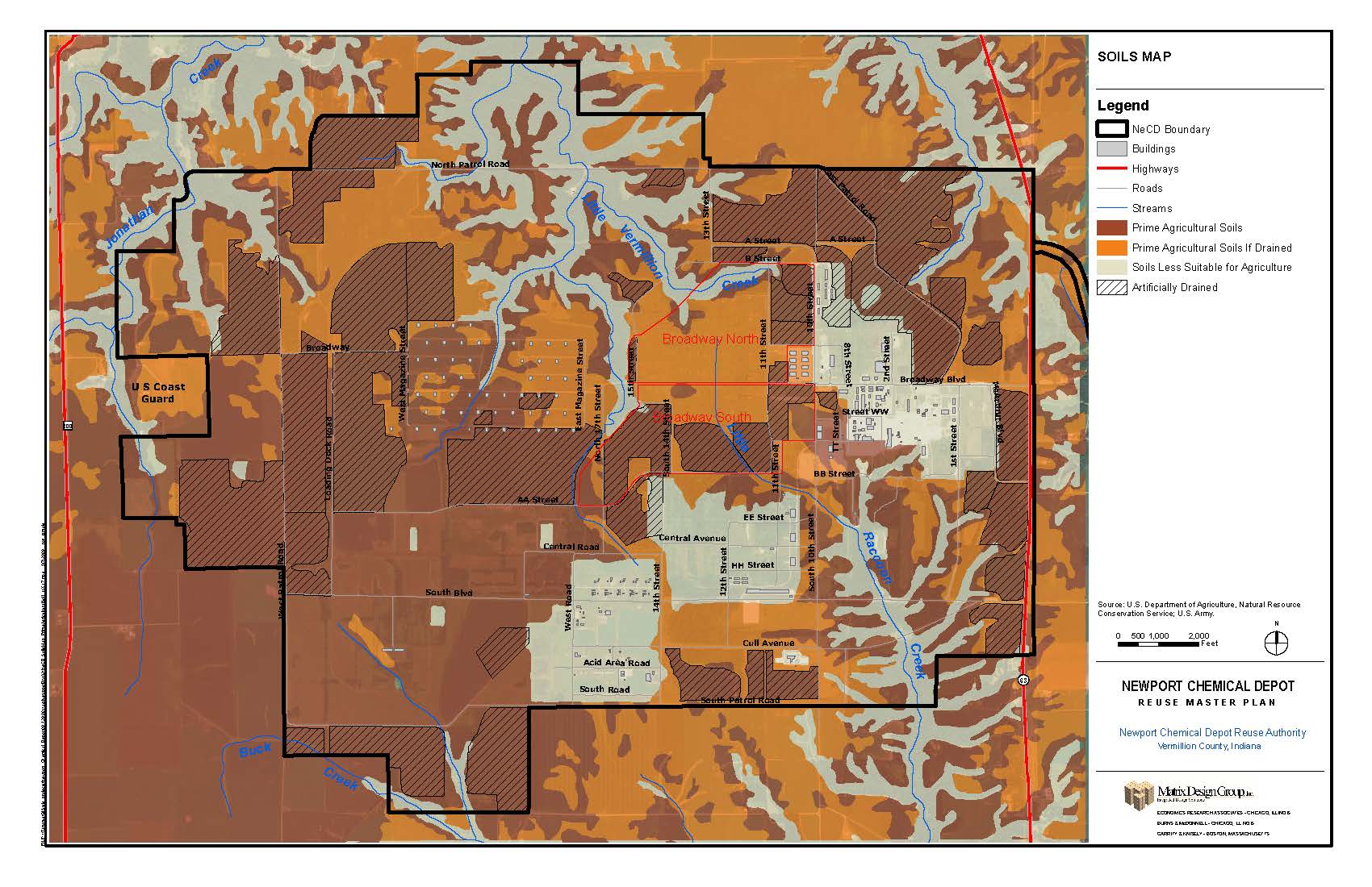
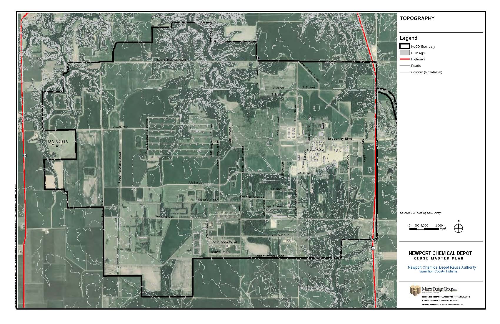
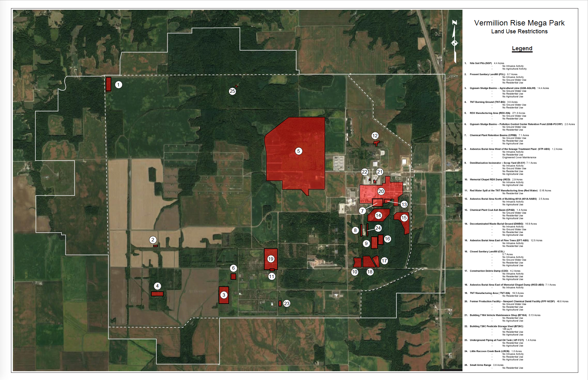
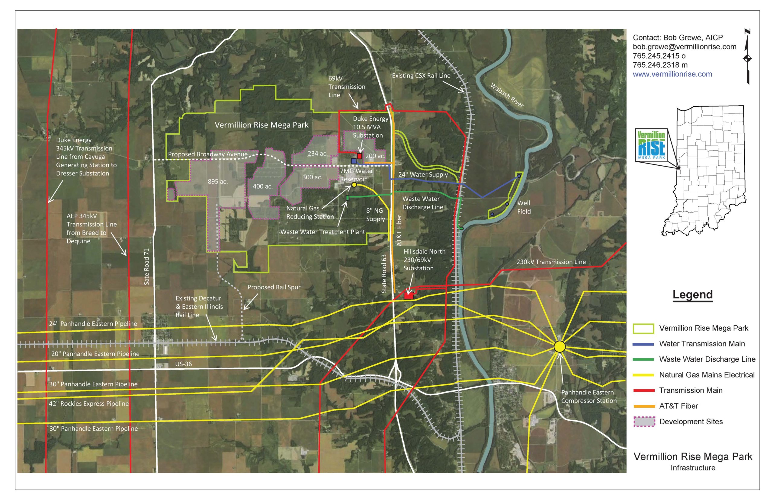
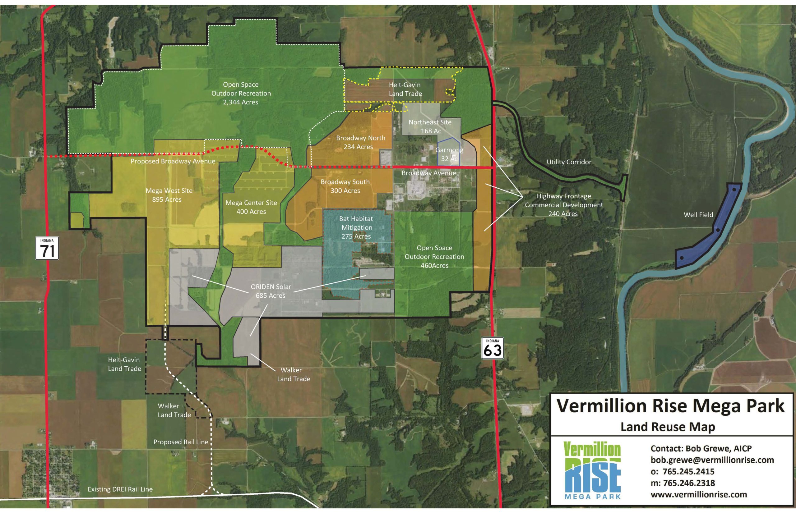
At Vermillion Rise we have in-house GIS mapping capabilities and can produce maps to meet your specific requirement based on your particular project. Below are links to available maps for quick reference. In addition, below on this page is an interactive map offering several layers of data for your use.
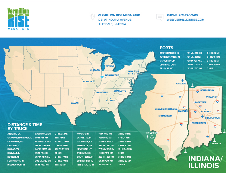
Additional mapping resources for Indiana are available at the IndianaMap website: http://maps.indiana.edu/
The GIS Layered Mapping tool below will create graphic representation of labor, demographic, geographic and consumer expenditure data. Start by selecting a location from the dropdown menu and selecting a criteria from the topic areas.

